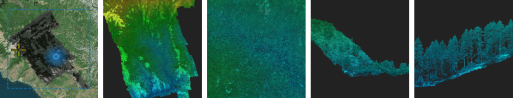
GEO1 won awards in two categories at the 2021 MAPPS Geospatial Excellence awards for their LiDAR and imagery acquisition of Muir Woods National Monument in Northern California as part of the Earth Archive project.
“The entire GEO1 team was pleased to work on the Muir Woods project to document, preserve, and analyze one of the greatest treasures in the USA,” stated Ron Chapple, CEO and Founder of GEO1. “Our partners, including The Earth Archive, Voxelmaps, and BayesMap all contributed time and resources to creating this lidar data set that will serve current research and generations to come.”
Lidar processing for this project was generously contributed by BayesMap using Wavex and StripAlign. The data will be visualized on an online platform powered by Voxelmaps, which offers the capability to perform AI-driven data analysis at an individual tree level, prior to being incorporated in the USGS 3DEP database.