Our strip alignment software is now able to correct the relative geometry of challenging corridor projects while preserving, or even improving the absolute accuracy of the LiDAR point clouds.
In large corridor mapping projects with very limited flight line overlap (see illustrations) default options may yield large mean corrections and a degradation of absolute accuracy. StripAlign was recently improved to help deal with these difficult situations – where adding more overlap by increasing the number of flight lines is simply not possible due to cost constraints.
New options help improve results significantly when the HF component of IMU errors is the dominant source of misalignment. In general, there is enough overlap for calibration to work correctly, and rigorous corrections provide excellent results in terms of absolute and relative accuracy.
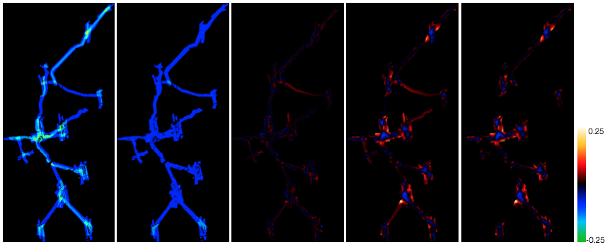
The input data has misalignments of +/- 10 cm in some areas and the best correction is only a few cm.