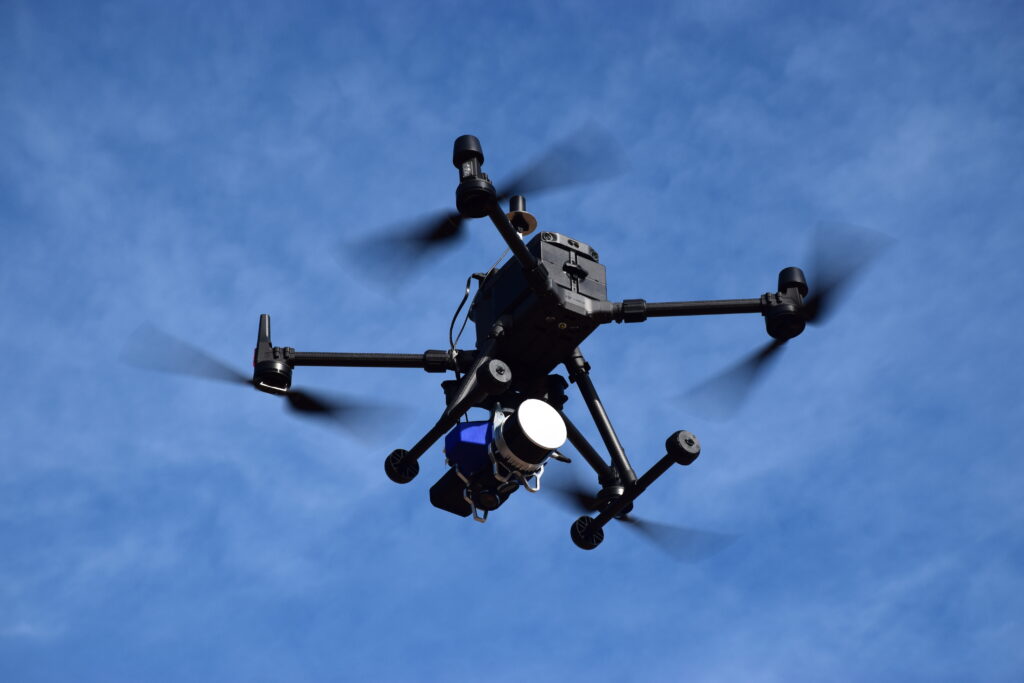
Huntsville, AL – GeoCue Group Inc. and BayesMap Solutions LLC are pleased to announce the release of our new geometric correction software for the True View series of small Unmanned Aerial Systems (sUAS) 3D Imaging Systems (3DIS®). Historically, geometric correction of LIDAR data has been an arduous process requiring Byzantine parameter adjustments and numerous trial runs. GeoCue has been working with BayesMap for the past several years to develop an add-on to our True View EVO software that allows “one button click” geometric correction of sUAS LIDAR data with no need to adjust algorithm parameters. This effort has culminated in the creation, by BayesMap, of StripAlign for EVO (SAfE).
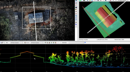
Geometric errors are introduced into LIDAR data sets by two general mechanisms (assuming one has a good sensor to start with!); poor system calibration and/or GNSS/IMU estimation errors during flight. Calibration can be addressed by being very particular with system rigidity during design and developing exacting calibration procedures. GeoCue does both of these exceedingly well. GNSS and IMU estimation errors cannot be corrected via sensor design since these errors are inherent in the position and attitude sensors during flight. We do mitigate this in the True View sensors by using very high-quality Trimble/Applanix APX series Position and Orientation Systems (POS) but data can exhibit small geometric inconsistence, especially when combining data from multiple flights. BayesMap StripAlign for EVO detects and corrects these errors via an application of sensor-specific mathematical modeling.
SAfE is an optional extension to True View EVO, GeoCue’s post-processing and exploitation software bundled with True View sensors, that integrates directly into the workflow using EVO’s new Job Manager subsystem. The Job Manager allows users to work on other projects within EVO while SAfE is processing. SAfE is a fully automated process with no need for users to set project-specific “tuning” parameters or to move in and out of the EVO processing environment – press a button and it just works!
SAfE in available now. It will be bundled with all True View 515, 635 and 640 3D Imaging Systems shipped after September 1st, 2021. It is available as an optional purchase for all other EVO-supported LIDAR sensors.

About GeoCue
GeoCue is the largest supplier of kinematic LIDAR processing tools in North America and LP360 is one of the world’s most widely used tools for exploiting point cloud data. In 2014, GeoCue Group started a division focused on using small Unmanned Aerial Systems for high accuracy mapping. Leveraging our expertise in LIDAR/Photogrammetric production, risk reduction, and point cloud processing tools, we are continuing to bring new services and products to market to provide surveyors and other geomatics professionals exciting tools for geospatial data extraction. Our most recent addition is our fused LIDAR/Camera drone surveying system, the True View® 3D Imaging System (3DIS®) product line. True View 3DIS offer compete hardware/software solutions for drone mapping from topography collection to high accuracy DOT work. To learn more, visit www.geocue.com.