Accurate LiDAR gridding with innovative filtering and uncertainty
Advantages:
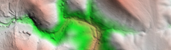
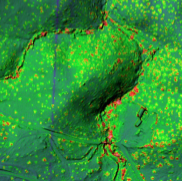
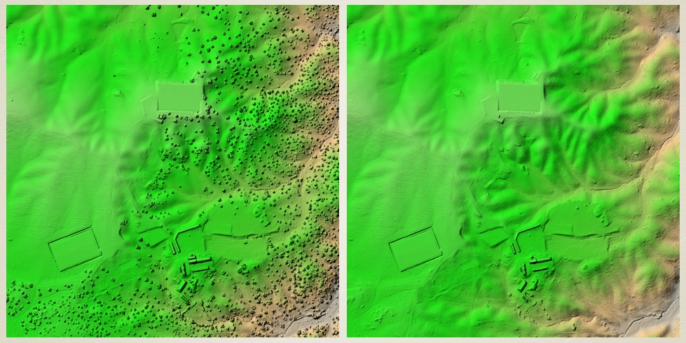 Left: surface model generated from last returns. Right: same with ground filtering applied on each scanline, eliminating last returns coming from vegetation or other non-ground targets. The gridding was performed using an ultra-fast technique, suitable for real-time gridding, followed by an iterative refinement to gain accuracy. Color-coded elevation and shaded relief.
|
Your benefitsAccuracy improvementBayesian inference is not only about producing fuzzy quantities! It actually ensures that results have maximum accuracy, compared to ad-hoc or classical approaches. Proper modeling ensures reduced errors: adequate surface models and high order interpolation are used to obtain high accuracy gridded products. Optimal data fusion, or swath combination, helps produce highest possible accuracy elevation models given the collected data. During gridding, 3D points are given weights according to their uncertainty, so that most accurate points have the strongest influence on the final product. Jointly using outlier and topographic surface models, and then applying Bayesian inference to perform ground filtering, is a powerful way to improve the data accuracy. AutomationManually tuning essential processing parameters is no longer necessary. Surface smoothness, outlier frequency, that’s the algorithm’s problem, not yours! Deciding at what scan angle to cut off data is over! Uncertainty propagation ensures a proper weighting is applied to each data point, avoiding throwing away precious information and significant portions of the input point clouds. Uncertainty managementManaging uncertainty properly allows not only to propagate errors, but to preserve information by using error structure (e.g. covariances). Understanding how uncertainty affects elevation is essential for shape analysis and change detection. Also, assessing the statistical significance of events (e.g. change or flood) requires spatial uncertainty. This does not come with the data, but we help you compute it! |
BayesMap Solutions
We increase the accuracy of your data and save you and your clients money