
SOFTWARE & SERVICES
Software and consulting for LiDAR you can trust.
Probabilistic LiDAR software and expert consulting for airborne and terrestrial laser scanning. We analyze, model and process your data, increasing accuracy, quantifying uncertainty, and cutting your project cost.
TRUSTED BY MAPPING & GEOSPATIAL TEAMS




WHAT WE DO
From raw point clouds to decisions.
Consulting services
Innovative LiDAR processing for airborne and terrestrial laser scanning. We analyze, model and process your data, and help you define the collection requirements that fit your needs.
Software packages
Highly optimized, multi-platform LiDAR software with unmatched performance. Improved accuracy, reduced project costs, remote calibration and full support. Free 30-day trial.
The research behind it
LiDAR & image processing built on Bayesian inference and probabilistic modeling. Meet the founder, browse academic publications and recent LiDAR projects.
THE SOFTWARE
Production-ready, built to fit your pipeline.
Every BayesMap package is a standalone, multi-platform tool you can drop straight into a production workflow: efficient, scriptable, and fully supported. Buy only what you need; nothing depends on anything else.
- ✓Every package can be purchased and run independently, with no hidden dependencies
- ✓Free 30-day evaluation with fully functional products; request a demo license
- ✓Computationally efficient implementation with multi-core support
- ✓Multi-platform: Windows, macOS and Linux (64-bit)
- ✓Simple command-line interface, minimal training cost and time
- ✓Compatible with major cloud computing platforms
- ✓Flexible floating licenses
- ✓Ready for batch processing and production pipeline integration
- ✓Reads and writes LAS/LAZ, compatible with other LiDAR software
- ✓Full email support included; remote calibration, testing and consulting available
FLAGSHIP SOFTWARE • STRIP ALIGNMENT
StripAlign 2.29
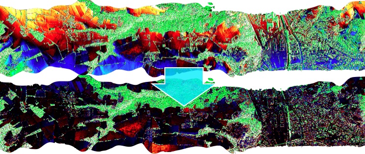
Fast, robust, fully automatic flight-line adjustment. Using swath overlaps, it registers point clouds onto each other and corrects boresight, lever-arm and high-frequency drift, cutting discrepancies between swaths and improving relative and absolute accuracy, even on very large datasets.
FLAGSHIP SOFTWARE • WAVEFORM EXTRACTION
WavEx 2.02
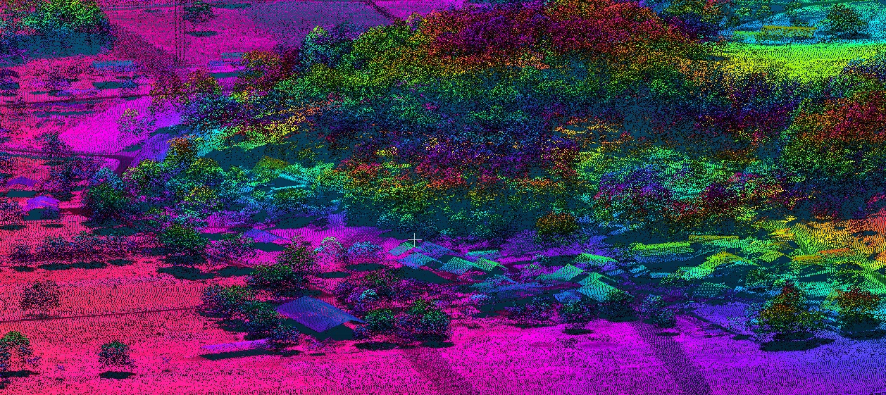
Extracts 3D points from raw full-waveform LiDAR files: more points and more accurate results even at high altitude and in difficult cases with low vegetation. Single-pass decoding, processing and georeferencing keep throughput high on production volumes.
WHY BAYESMAP
Probabilistic by design. Practical by experience.
Uncertainty maps
Every run comes with QC maps, statistics and reports, and per-point uncertainty can be exported, so you know where your data can be trusted.
Expertise from experience
Over 20 years of Bayesian inference applied to LiDAR, photogrammetry and data fusion, backed by peer-reviewed research.
Time-saving generation
Optimized algorithms deliver accurate topography at high throughput, robust to collection artifacts and vegetation.
FREE EVALUATION
See what your data is really worth.
Send a sample dataset. Get your accuracy gain back, free.