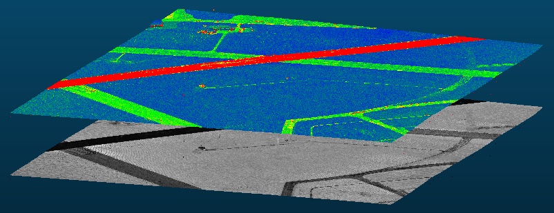
BayesWavEx prototype (V1.0) released. Request a demo now! See licensing page for details. The picture above shows the range uncertainty layer (exported as a LAS extended attribute) above the corrected intensity. The predictive range error depends on peak shape,...
SSA 2016 Exhibit, Booth #3
We will be at the SSA 2016 meeting (Seismological Society of America) in Reno, NV – April 20-22, 2016. Visit Booth #3 to learn more about LiDAR point cloud processing using BayesMap software and services, and also for a demo of StripAlign, our new point...
ILMF 2016 Exhibit, Booth #95
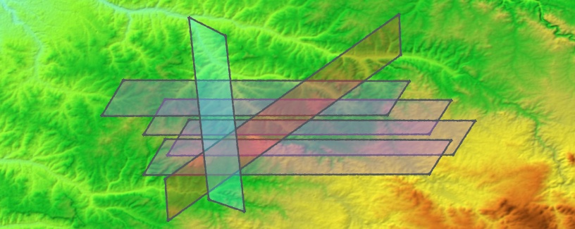
We will be at the International LiDAR Mapping Forum (ILMF), Denver, CO – Feb 22-24, 2016.Visit Booth #95 for a live demo of BayesStripAlign, our new point cloud alignment software! With a short, yet powerful command line you can reduce the geometric errors to get the...
BayesStripAlign 1.2 released
BayesStripAlign version 1.2 for both Windows and MacOS 64-bit was released on Feb 10, 2016. This version includes a number of bug fixes and improvements. New features – calibration:– Multichannel sensors such as Riegl Q1560 can be used– Arbitrary geometry (not only...
BayesStripAlign 1.1 available now!
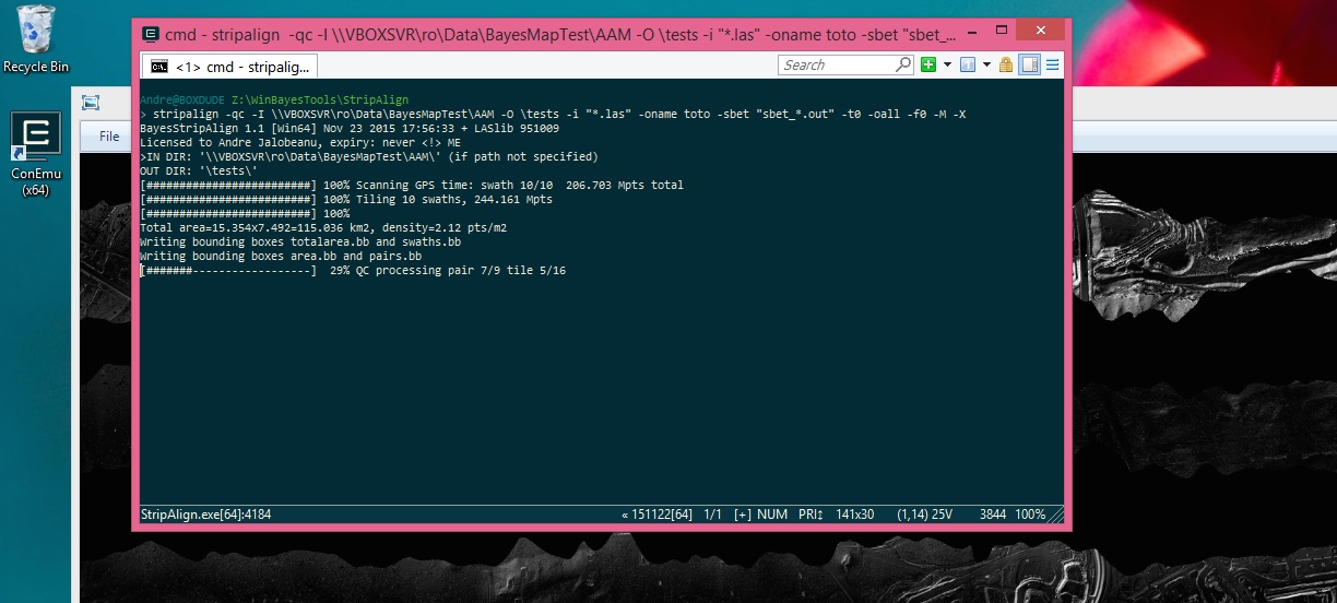
We are pleased to announce that BayesStripAlign version 1.1 for both Windows and MacOS 64-bit is now available. It is provided as a command-line tool (shown here on Windows 8.1 with the ConEmu interface). It includes an embedded help and option list. The full...
BayesMap at UAS Reno 2015
We will be at the ASPRS UAS Technical Demonstration and Symposium, Sept 29-30, 2015 in Reno, Nevada. Meet us at the exhibit booth #205 to try our new LiDAR strip alignment software! [download the floor map]
BayesStripAlign 1.0 [Mac OS] available now
The first version of the strip alignment package, BayesStripAlign 1.0, has been released. It’s a Mac OS only version, with a basic (yet fully functional) command line interface, and the Windows version will follow very soon. It features automatic absolute and relative...
BayesMap at ILMF 2015 in Denver
We are at the International LiDAR Mapping Forum (ILMF) 2015 in Denver, Colorado, USA. Find us at the exhibition – meet us at booth 39! [download floor map]
BayesMap at AGU 2014 in San Francisco
We will be at at the AGU Fall Meeting, San Francisco, 15-19 Dec 2014 Abstract Title: Automated Probabilistic LiDAR Swath Registration Final Poster Number: EP41B-3539 Session Title: EP41B. High-Resolution Topography and Process Measurements for...


![BayesStripAlign 1.0 [Mac OS] available now](https://bayesmap.com/wp-content/uploads/2026/02/before-after-stripalign-1.jpg)